It’s no secret that technology is advancing at a rapid pace. By the time you get familiar with the latest computer software, there is already a newer version. Technological advances are causing the workplace to undergo constant, fast-paced change, and the world itself has gotten much smaller because of it. Businesses have to continually adapt to keep up in such a rapidly changing workplace. Because of this, it is critical that communities stay up to speed in order to attract and retain businesses and foster economic growth throughout the community.
One way communities are utilizing technology in their economic development programs is through the use of geographic information systems (GIS). A GIS integrates hardware, software and data to capture, manage, analyze and present all forms of geographically-referenced information. Information such as population, unemployment rates, median age, median household income and education level is digitally displayed on a map of the region, rather than in chart form. This allows individuals, site selectors and business owners looking to expand or recruit to better analyze regional demographics and better decide on future business operations.
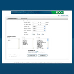
The Economic Development Council for Central Illinois currently provides GIS data online for businesses in the surrounding communities through a similar system. With the Location One system, site selectors are able to access our website and building database and view available properties throughout the region. The nice thing about Location One is that it is a regional effort, with all data in a central database. It shows properties throughout the region, not just in a single community. Selectors are able to access property information and see where properties are in relation to interstate highways, railways and other communities throughout the region. The system also shows the location of trade schools, post-secondary schools and hospitals.
Location One also has a layering feature, enabling site selectors to view multiple dimensions at once, such as county boundaries, population, railroads and more. The EDC plans to continuously upgrade its information systems with even more advanced features. Efforts have already begun and will continue to grow over the next 12 months or so. By upgrading the layering feature, site selectors and businesses looking to expand will be able to view electric lines, waterways, sewer systems, enterprise zones, TIF districts and other economic development layers to better determine whether a property is right for their business—and they will be able to do this all without having to leave their desks.
“As technology advances, the world we work in is becoming smaller,” stated Vickie Clark, president of the EDC. “Technology enables people to do business with those all over the world without stepping foot outside the office. That’s why it is so crucial for businesses and economic development centers to stay up to speed with the technological advances of today.”
Nowadays, site selectors do not need to travel across regions to view specific properties, or understand a region’s layout. Systems like Location One and other forms of GIS allow for businesses looking to expand or recruit to access and view property information across the country. This kind of capability provides communities with the types of opportunities necessary for great economic development. Businesses can analyze regional demographics and geographical landscape at the same time, and can thus better choose their next business enterprise. iBi

