Regional Land Use Scenario Planning

While scenario planning has been conducted in cities like Denver and Salt Lake City for decades, the concept is new to most regions.
Take a moment to consider your community’s built environment. Where are the residential and commercial spaces? What do they look like and how do they function? What transportation system connects commerce and the people? Consider the wide-open spaces that provide valuable natural resources for the region. How does the built environment impact your daily life, and how would you like it to change in the future?
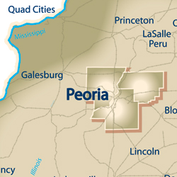
In September of 2013, the staff of Tri-County Regional Planning Commission (TCRPC), in partnership with the Heart of Illinois Sustainability Consortium and with funding from the HUD Sustainable Communities Regional Planning Grant, asked 50 local stakeholders to design future development scenarios that reflect their quality-of-life values. This activity is known to land use planners as scenario planning. In this process, groups of five or six gathered around maps of the Peoria/Pekin region, and under the confinements of future population growth projections, made recommendations on the type and location of the built environment over the next 30 years. Participants identified areas of commercial and residential development, as well as natural areas they wished to protect, and made recommendations for new roads and trail systems.
The results? There was a lot of overlap among the groups. Many placed medium to low-density residential development in the smaller, more rural, satellite communities. Because of current issues with high vacancy rates and the hollowing out of the urban core, participants were provided the option of “neighborhood reinvestment,” in addition to green development. Participants placed neighborhood reinvestment and higher-density, mixed-use development in the urban center. Groups also connected regional bike/pedestrian trail systems, placed a bridge over the Illinois River near Mossville, and protected the forested areas of the Illinois River bluffs. The differences came when groups realized their limitations on population growth; here, they had to make hard decisions on where to direct urban versus rural growth.
What does it all mean? We cannot simply stop at a pretty picture on a map. TCRPC staff are currently digitizing the mapping results and running future land use models with Geographic Information Systems (GIS) software. Given a development scenario, the inputs of location and type of development provide outputs on the fiscal impacts to local governments, road congestion, loss of agriculture and natural areas, water and energy consumption, and more. This analysis of future development is being conducted on a regional scale, which is significant because specific development impacts are often only considered from the perspective of a single jurisdiction. Be mindful that inter-jurisdictional competition for development could lead to decisions that are less desirable for the region as a whole, thus there is value in a regional entity conducting this analysis with input from the public.
The portion of the model involving the fiscal impacts of development is particularly useful in this process. The fiscal calculator model, developed by Teska Associates, Inc. for the Tri-County Area, takes into account the cost of basic government services and the tax revenue of specific development types to estimate the overall fiscal gain or loss to the community. These models, while serving as an estimation of development impacts, also serve to provide accountability of decision-makers on land use decisions.
While scenario planning has been conducted in cities like Denver and Salt Lake City for decades, the concept is new to most regions. Through the HUD Sustainable Communities Regional Planning Grant program, TCRPC has been working with NGOs and regional planning agencies throughout the nation to elevate local expertise and build capacity for long-term planning and decision-making as it relates to sustainable futures.
A special thank you to all who attended the public mapping event. If you did not hear about the event but would like to participate in similar activities in the future, let the staff at TCRPC know how to notify you. As communities approach environmental and economic limitations, look for land use planners and decision-makers to rise to the challenges of sustainability and creating vibrant communities through new technologies and programs supported by extensive public involvement. iBi

